Projects

Hotel, Echo, Yankee!

Map of SKY/opegieka projects

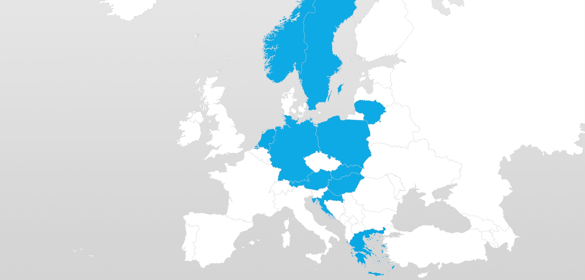
The following map presents coutries in which we have been executing projects for you. Each of them set a different challenge for us, but also was a great adventure. Possibility of working in highlighted countries makes us proud. However it is still not enough! We would be more than happy to try our's hand at flying in another countries.


Click on selected country to find out more.

Sweden

LiDAR and orthophoto map

2015: performance of an orthophoto map and scanning of power lines in the central part of Sweden.


2019: acquisition of imagery and a dense point cloud by means of the dual frequency laser scanner for the purposes of carrying out forest analyses.

Norway

LiDAR

2018: acquisition of LiDAR elevation data near Ålesund in the region of the highest Norwegian fjords. The unstable weather conditions contributed to the fact that the project was exceptionally difficult to be executed.

Lithuania

LiDAR, vertical photographs (images) and orthophoto map

2015-2017: performance of the orthophoto map of the entire country


2017: acquisition of airborne laser scanning data of density not lower than 30 points/m2 and aerial images for the area of 10 biggest towns in Lithuania.

The Netherlands

LiDAR

2018: the project concerning acquisition of LiDAR data and bathymetric data concerning the harbour area of Rotterdam for the purposes of the analyses conducted by the national hydrographic authority.

Germany

LiDAR

2018: acquisition of LiDAR elevation data for the region of Baden-Württemberg and Thuringia.

Poland

Vertical, oblique and thermal photographs (images), LiDAR and orthophoto maps

2011-2019: execution of a number of remote sensing projects in Poland, such as acquisition of elevation data for major geodesic and surveying entities in the country, i.e. the Head Office of Geodesy and Cartography (GUGiK) or the Agency for Restructuring and Modernisation of Agriculture (ARiMR). The thermal map of Elbląg and oblique photographs for Słupsk are also worth mentioning in this context.

Austria

Vertical photographs (images)

2012: performance of aerial images within the framework of the LPIS project on the territory of Austria: in the western part of Weinviertel area, in the vicinity of Graz and the Lower Tauern mountain range.

Slovakia

LiDAR

2018-2019: acquisition of LiDAR elevation data for areas situated within the entire country, e.g. the vicinity of Bratislava or the Low Tatras mountain range.

Hungary

LiDAR and vertical photographs (images)

2013-2015: acquisition of elevation data for all important watercourses on the territory of Hungary.

Croatia

LiDAR and vertical photographs (images)

2012: acquisition of airborne laser scanning data for Plitvice Lakes National Park in Croatia


2018: synchronous acquisition of LiDAR data and vertical images for Dubrovnik.

Greece

LiDAR and vertical photographs (images)

2018: synchronous acquisition of airborne laser scanning data and imagery for the purposes of the archaeological research (excavations) in the region of central and southern Greece. The project was executed in extremely adverse weather conditions.

OPEGIEKA Sp. z o.o.

Click here for directions.

Head Office

Aleja Tysiąclecia 11

82-300 Elbląg

phone: +48 (55) 237 60 00

fax: +48 (55) 237 60 01

E-mail address:

sky@opegieka.pl

Branch in Warsaw

ul. Grzybowska 80/82 lok. 700

00-844 Warszawa